

Following in the Steps of a King: Walking The Monarch’s Way
The opportunity to join ‘old’ friends for a few days walking was too good to miss. Fearing in these COVID-19 times that any introduction of regulations banning the mixing of households could force us to cancel our arrangements, it was a relief when we knew we could still go ahead as intended.

The route chosen was The Monarch’s Way, a lesser known long-distance footpath in England that traces the escape route taken by King Charles II after his defeat at the Battle of Worcester in 1651. Its rather tortuous route runs for over 600 miles from Worcester via Stratford upon Avon, Bristol, Mendip Hills to the Dorset coast, turning back inland via Yeovil, before heading eastwards through Wiltshire and Hampshire to end at Shoreham on the West Sussex coast.
The route was well waymarked but still provided scope to use ‘old’ map reading skills, while the latest mobile technology provided a back-up whenever there were doubts. When a hidden stile is missed in an overgrown hedge, checks on these apps can certainly help the casual walker avoid taking any unfortunate wrong directions!
Day One

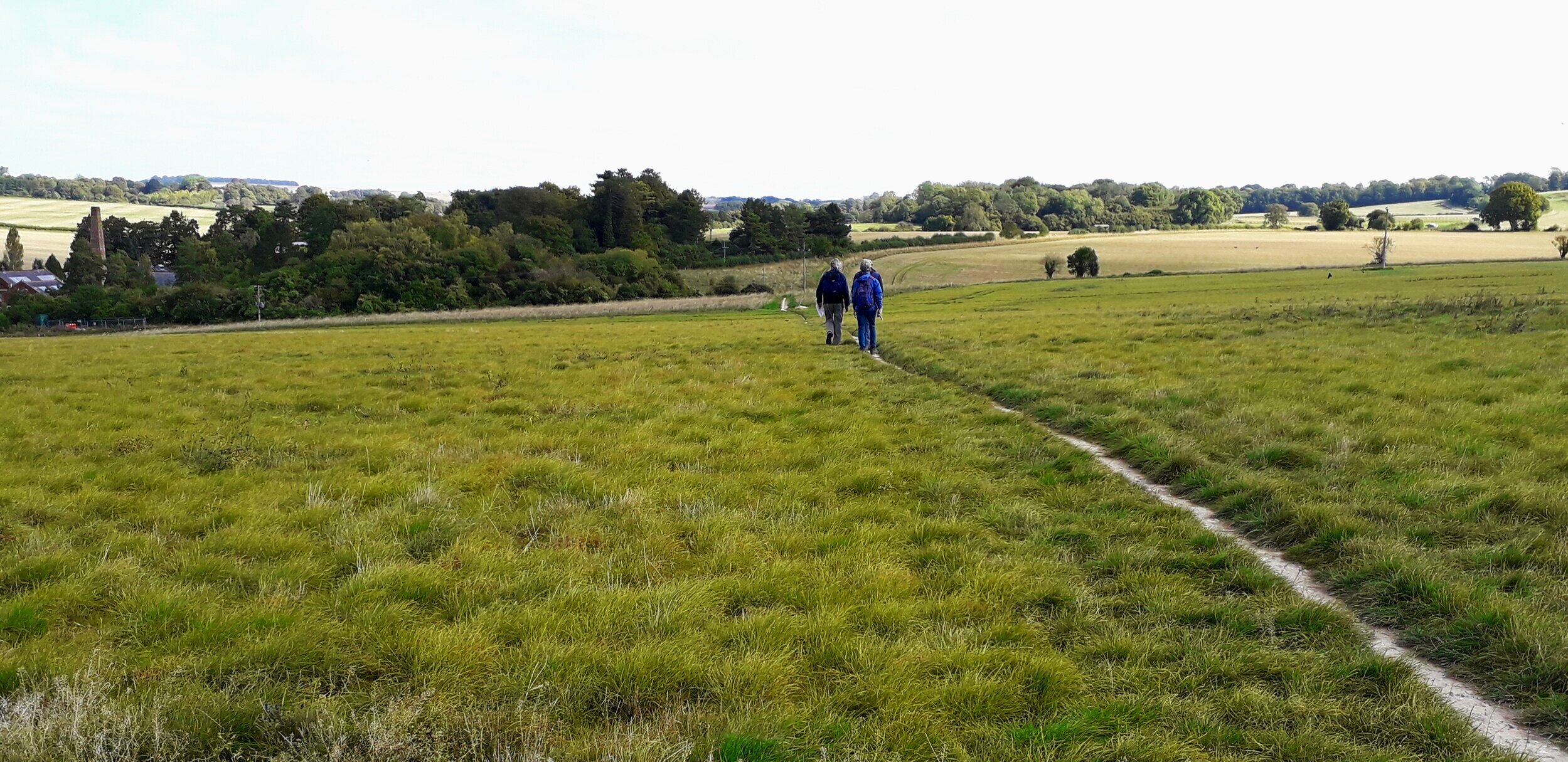
Open countryside on the Wiltshire-Hampshire border
There was no intention to walk the route’s whole length. Instead, we picked the path up at Middle Winterslow on the Wiltshire / Hampshire border. The wide track headed east along an old Roman Road through the gently undulating countryside of farmland and woods. After a while the path turned towards Broughton village.
Narrow miss

What could have been if we had been a minute earlier!
As we walked through the leafy glades of Smith’s Plantation, an unusual sound broke out ahead, like a vehicle struggling for traction on loose material. There was a momentary pause before the noise was heard again. This time, we realised something else all together had happened. We continued around the track’s gentle curve and saw that a cyclist from the opposite direction had stopped and began striding back from where he had come. Even though we were still some 50 metres away, we could clearly see that a large tree had crashed down and was blocking the path. A minute earlier this beech tree could have been falling on us! As it was, it had come down only moments after the cyclist had passed by it. The shaken cyclist told us that he had returned to look for his companion. Fortunately, his mate appeared unhurt. If he had been following closer behind, it might easily have been a different story. After surveying the scene, we were all relieved to be able to safely resume our respective journeys.

Rich meadow grazing in the Test valley, near Houghton
Despite this incident, the filtering autumn sunlight was particularly delightful as we continued on the path through the still mostly green-leafed mature woods. In contrast, long, straight farm tracks composed of loose stones and crunching gravel, felt more of a trudge later in the morning. Gratefully, conversation and banter seemed to make the distance that bit shorter before we arrived in Houghton. By now it was time to search for a suitable lunch spot. Unfortunately, the grassy bank by the footbridge over the River Test was newly fenced off. After pausing on the bridge to appreciate the tranquility of the river scene, we enclosed path took us past the grazing sheep and cattle in the meadows. Soon we turned south and our route now merged with the Test Way. Along this stretch it followed the railway track of the former branch line that once ran between Andover and Redbridge, near Southampton. More commonly known as the Sprat and Winkle Line, it opened in 1865 and operated until 1967 when the line was closed as a result of the Beeching cuts.
Continuing in woods, there was no obvious resting place until we eventually came to an old railway bridge passing above a side channel of the river. The bridge’s iron structural sides provided us with a place to rest and enjoy our packed lunches. Soon after getting our stiffened legs working again, we caught glimpses through the hedge of the preserved remains of Horsebridge Station, a railway carriage and replacement signal box that has now become an unusual wedding venue.
Shortly after, we crossed back over the Test, noticing the signs declaring ‘No public access’ to keep us away from the river banks. Both the Test and its similar chalk spring ‘sister’ river, the Itchen, are world renowned for their fly fishing that is integral to the local economy. Although much effort has been given in recent years to generally open up the countryside, through measures like ‘Right to Roam’ legislation and Permissive Paths, it feels there are unlikely to be concessions to any such pressures in this area of Hampshire. By now the afternoon sun felt warmer to the point where we could reduce our layers before tackling the final stretch across sheep grazed meadows and on into Mottisfont and the National Trust estate. By this point, the day’s exertions were now being felt in the legs!
Day two

Protecting access to the fishing banks of the River Test!

St Mary’s Church, Michelmersh
The following morning, we resumed at Mottisfont and began to get the residual stiffness out of our legs. Kimbridge Estate sign boards expressed the steely intent to protect the fishing rights along this stretch of the Test, before a bridge took us over the river for the last time. Soon we were leaving the valley behind as we climbed steadily up the narrow country lane to Michelmersh, prior to passing through the graveyard of St Mary’s Church with its distinctive wooden tower. The route now became more varied as it took us through woodland, along farm tracks and across open fields. Most seemed arable or improved pasture but occasionally we would walk into a field of cows while overhead, a buzzard or red kite would soar.
Skirting around Braishfield to the village pond, we again picked up a paved country lane for a mile or more before diverting into Ampfield Wood. Sometimes an array of forestry tracks can cause directional confusion, but on this occasion, we were able to find our route quite easily. We wandered through the hamlet of Knapp before re-emerging from another part of the Wood into more open countryside. The grassy path continued between a well-maintained avenue of trees, passing close to Hursley Park where probably the last cricket game of this truncated season was being played, before finally arriving at the outskirts of Hursley village itself.
Day three

Crossing the Rover Itchen, near Twyford
In the morning, we climbed out of Hursley via an initial narrow lane and the boundary edge of a graveyard before striding out along field margins and farm tracks. Being the last week of September, the harvest had clearly all been gathered and many fields had been ploughed anew. After passing under the motorway, we dropped down into Shawford to pick up the lane that crossed the meadows of both the Itchen Navigation and the River Itchen itself. Rather like the Test, the Itchen also seems to have many channels. Reaching the village of Twyford, we rewarded ourselves with a welcome Sunday morning coffee – on the terrace of a COVID secure café, of course!
Resuming our route, we began to leave behind the gentle valleys of the Test and Itchen that characterise central Hampshire, and rose towards the western edges of the South Downs. Surprisingly for the middle of the day, two deer seemed content to stand in the middle of an open field without any cover. We managed to find a sheltered lunch spot, before our gentle climb brought us to the village of Owlesbury.

Farming with ecological and biodiversity considerations to the fore!
Although we had observed some instances the previous day, it became more noticeable that some farmers had left field margins for environmental benefit. In some cases, farmers appeared to have purposely seeded such areas for wildflowers including sunflowers, in recognition of their responsibility to support and improve biodiversity.
By mid-afternoon, and after more than thirty miles of highly enjoyable walking over three days in good company, we finally reached Upham. Here, we bade our farewells, vowing to do something similar again in the future. With some sadness, I now left the others to continue their trek further eastwards.
Despite strong northerly winds, the three days had been dry with large parts of each day graced with blue skies. With clear views to the horizons these conditions provided excellent autumnal walking weather. In sheltered spots, it was still possible to feel the waning warmth of the sun, feeding the quest for finding the perfect lunch spot!

Sunflowers planted at the field margin with Owlesbury church appearing in the distance
Even though we were never far from villages and knowing that the cities of Winchester and Southampton were not so far away, this walk was a reminder that it does not require a huge effort to get out and ‘away from it all’. Even if there is a bit of kidology involved, this ability to access tranquility, nature, and appreciate an ancient landscape should never be under-estimated especially in Southern England. From afar, villages like Broughton, Braishfield and Owlesbury appear embedded into the scene, evidence of a landscape that has long been tamed. Despite COVID-19 and current pressures to build more housing and reform the planning system, there still remains something special about the English landscape that retains both a quality and a degree of permanence that is hard to find elsewhere in the world.
The bigger picture and how to help value our footpath network
Striding out across part of the network of footpaths that need to be valued and protected
In places our chosen path merged on some stretches with other routes, some of them long distance and well known. such as The South Downs Way. Others are more local like the Clarendon Way on day one, or the Kingfisher Trail around Twyford, that arise from more community or independent initiatives. Taken together it was very much a reminder of the extent some areas of Great Britain are criss-crossed by a network of designated and unnamed footpaths – perhaps something quite unique in the world. Intriguingly, the self-proclaimed ‘guerrilla geographer’, Dan Raven-Ellison, has developed the concept of Slow Ways, mapping a network of routes the length and breadth of Great Britain that help value alternative ways to enable people to walk off-road between towns and cities without relying on a car or bus. With a graphically designed snail for a symbol and likely waymark, the project will soon be calling for volunteers to help explore, test and feedback on these assigned Slow Ways. Why not join in the effort?

Spoilt for choice!
Of course, the time that people have available for using these Ways will always be a factor, but they nevertheless recapture the essence of how vital these paths were for communities in days when a horse was probably the quickest mode of transport. The ancient routeways, often hemmed-in by embankments on either side as they sink into the terrain, for instance, leave a legacy of their past common usage. Today, our dense network of footpaths should not be taken for granted. Walkers often find paths poorly signed or maintained with landowners sometimes illegally blocking them off. The situation is not helped by resource-constrained county councils not being able to carry out their responsibilities as extensively as they had some years back.
The need to register unrecorded footpaths and bridleways
Crucially, ramblers and others have until 1 January 2026 to register all unrecorded footpaths and bridleways created before 1949 or risk losing access and rights of way. The Open Spaces Society and The Ramblers provide helpful guidance on how to go about seeking registration of any unrecorded rights of way, and several other organisations are also encouraging people to take up the challenge.
Why not help out in any way you can and continue supporting access to the countryside?
